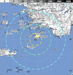
| (Photo credit: Wikipedia) |
In Brief
- Date: 16.12.2012
- Time: 07:03:05
- Region - Dodecanese Islands, Greece
- Depth: km 15
- Magnitude: 4,0
Earthquake Details
Magnitude
- 4.0
- Sunday, December 16, 2012 at 07:03:13 UTC
- Sunday, December 16, 2012 at 09:03:13 AM at epicenter
- Time of Earthquake in other Time Zones
- 35.215°N, 27.691°E
- 34.8 km (21.6 miles)
- DODECANESE ISLANDS, GREECE
- 54 km (33 miles) SE of Karpathos, Greece
- 139 km (86 miles) SSW of Trianta, Greece
- 144 km (89 miles) SSW of Rodos, Greece
- 169 km (105 miles) S of Datca, Turkey
- horizontal +/- 18.9 km (11.7 miles); depth +/- 10.2 km (6.3 miles)
- NST= 63, Nph= 66, Dmin=239.3 km, Rmss=1.07 sec, Gp=112°,
- M-type=body wave magnitude (Mb), Version=6
- Magnitude: USGS NEIC (WDCS-D)
- Location: USGS NEIC (WDCS-D)
Source - http://earthquake.usgs.gov/earthquakes/recenteqsww/Quakes/usc000ealj.php


